=> All the articles <=
 What was the wind effect for the cyclists during the Chamrousse climb for the 13th stage of Le Tour de France ?, by Frédéric Portoleau
2014-07-24, 18:16 - Frédéric Portoleau
Details about wind effect on power estimations for Chamrousse climb, by Frédéric Portoleau

Weather stations measurements
You can find accurate wind measurements for the Alps here :
http://www.romma.fr/index.php
The 18th of July 2014 was a typical summer weather, hot and sunny, with a rising breeze during the afternoon. The warmed slopes increase the vertical draft
(La météo de montagne, Jean Jacques Thillet, edition Seuil). http://en.wikipedia.org/wiki/Thermal
http://en.wikipedia.org/wiki/Vertical_draft
The Chamrousse weather station indicated a 6,4km/h wind speed at 17:20, from South-West (tail wind for the cyclists).
At the start of the climb, the Saint Martin d'Hè weather station indicated a 4km/h speed wind around 16:20, from North-West (tail wind for the cyclists).
Both stations are located 10m above the ground.
Other valley stations confirmed that the wind was stronger at altitude.
To make it easier, we can consider that the average climb wind was 5km/h (10m above the ground), from NW at the bottom of the climb, and then SW at the top.
Ground roughness
"High above ground level, at a height of about 1 kilometre, the wind is hardly influenced by the surface of the earth at all. In the lower layers of the atmosphere, however, wind speeds are affected by the friction against the surface of the earth."
http://www.motiva.fi/myllarin_tuulivoima/windpower%20web/en/tour/wres/shear.htm
Roughness classes and roughness lengths influence the wind profile, depending on its height.
The Chamrousse climb itinerary is 80% through the forest, and 20% through clearing and sparse habitations. The wind speed 2m above the ground (cyclist level) is approximatly half of wind speed 10m above the ground. Consequently, the tail wind for the cyclists was around 2,5km/h.
Chamrousse climb geometry
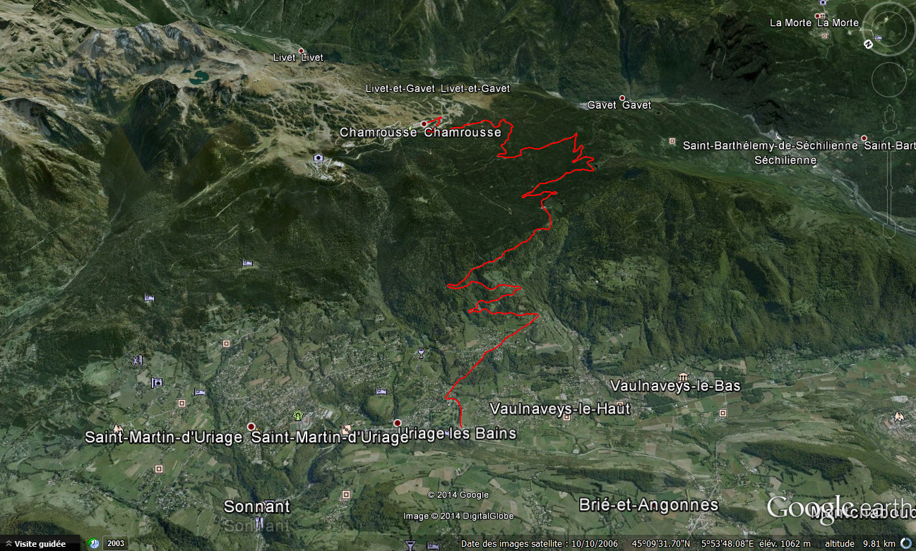
Nibali average spped in Chamrousse climb was 21.88km/h. If Chamrousse road was a straight line, the italian cyclist would have had a 2.5km/h tail wind. But it's a zigzag road, so he had less than 2.5km/h tail wind. He wen t through lateral and tail wind sections. An uninterrupted tail wind would mean that the wind direction followed the road direction, which is impossible.
Chamrousse climb is 5 km "as the crow flies". There is a 0.27 ratio between the itinerary distance and "as the crow flies". If we suppose that the wind direction was the same as the line that links the sarting and ending points, the cyclists had a tail wind 27% of the climbing time. 2.5 X 0.27 = 0.675km/h : to make it easier, we can use a 1km/h wind speed correction.


